
- 客服极速应答
- 30min答复
- 免费定制方案
Features
More channels and all constellations tracking
With 1760 GNSS channels solution, Galaxy G5 can support multi-constellation and multi-frequency tracking with the help of high-performance GNSS antenna.
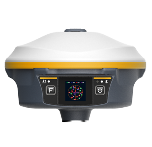
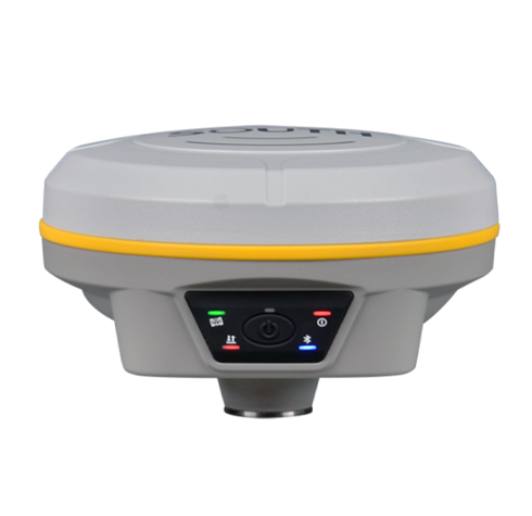
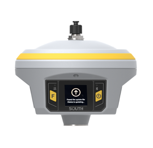
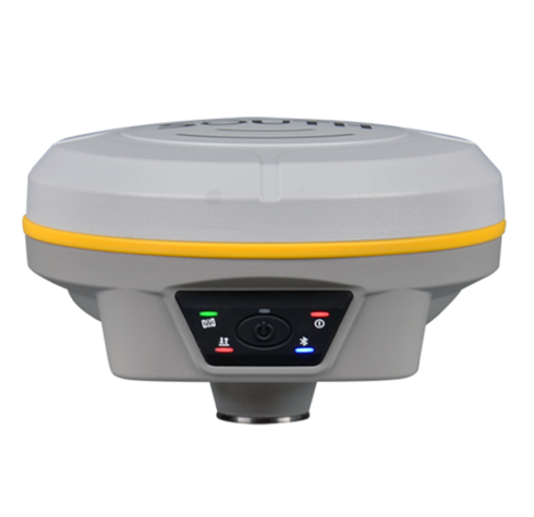
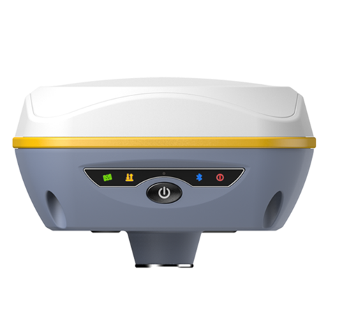
Color touch screen, makes workflow simpler
HD 1.3-inch color LCD touch screen with high brightness and low power consumption, which is convenient and efficient to complete touch settings, information browsing, function settings.
More powerful inbuilt radio
Coupling a high-performance UHF module with Farlink communication technology, which increases signal sensitivity and transmission efficiency, Galaxy G5 really achieves the goal of a 10~15km ultra-long-distance working range. And the power consumption of this carrying new generation module is 60% lower than additional UHF, making the Base working time is much longer.
Superior Endurance, Up to 25 hours working
Galaxy G5 uses a built-in 10000mAh ultra-large capacity Li-ion battery, which can last 25 hours of continuous work (Static) benefits from low power consumption circuit design. The Type-C interface is used on G5 that it can support fast charging through a charger with PD protocol, and it can be full charged in 4 hours.
Double data backup
The measured data can be simultaneously stored into both internal memory of receiver and controller, realizing the measured data double backup, which effectively avoid data loss.
Outstanding IMU measurement
Built-in 4th-generation IMU automatic compensator corrects the coordinates to the pole tip, assisting surveyors to quickly and accurately measure or stake out point at will without strictly leveling the receiver, the tilt angle range can achieve up to 60°.
Upward and hidden UHF antenna design
Upward UHF antenna design, achieving all-direction UHF signal receiving and transmitting. And the antenna interface is hidden into top cover that effectively avoid accident breaking, protect from water and dust.
Intelligent base signal locking technology
Using one-to-one signal tracking and locking technology, and the independent frequency under Farlink protocol, the G5 rover can continuously lock and capture the target base station signal to reduce cross-frequency interference even though other base stations are working nearby with the same channel.
Smart system management-ROS
Galaxy G5 is integrated with the ROS system, which comes with intelligent deployment of multi-mode hardware components, strong computing power and an intelligent scheduling mechanism, and coupling with an ultra-fine memory management mechanism, making the fluency and running speed of the receiver comprehensively improved.
Specification
| GNSS Features | Channels | 1760 |
| GPS | L1C/A, L1C, L2C, L2P, L5 | |
| GLONASS | L1C/A, L2C/A, L2P, L3CDMA | |
| BDS | B1I, B1C, B2I, B2a, B3 | |
| GALILEO | E1, E5 A, E5B, E5 AltBOC, E6 | |
| SBAS | EGNOS, WAAS, GAGAN, MSAS, SDCM(L1,L5) | |
| QZSS | L1C/A, L1C, L2C, L5, L6 | |
| Navic | L5 | |
| On module L-Band (Reserve) | ||
| Positioning output rate | 1Hz~50Hz | |
| Initialization time | < 10s | |
| Initialization reliability | > 99.9% | |
| Positioning Precision* | Real-time kinematic (Baseline<40km) | Horizontal: 6 mm + 0.5 ppm RMS Vertical: 10 mm + 1 ppm RMS |
| GNSS static | Horizontal: 2.5 mm + 0.5 ppm RMS Vertical: 5 mm + 0.5 ppm RMS | |
| Standalone | Horizontal: 1.2m Vertical: 1.9m RMS | |
| DGNSS | Horizontal: 0.4m Vertical: 0.7m RMS | |
| SBAS positioning | Horizontal: 0.6m Vertical: 0.8m RMS | |
| RTK initialization time | 2 ~ 8s | |
| IMU tilt compensation | Additional horizontal pole tip uncertainty typically less than 10mm + 0.7 mm/° tilt down to 30° | |
| IMU tilt angle | 0° ~ 60° | |
| Hardware Performance | Dimension | 165mm(φ) × 108mm(H) |
| Weight | 1.35kg (battery included) | |
| Material | Magnesium aluminum alloy shell | |
| Operating temperature | -45℃ ~ +65℃ | |
| Storage temperature | -45℃ ~ +85℃ | |
| Humidity | 1 00% Non-condensing | |
| Waterproof/Dustproof | IP68 standard, protected from long time immersion to depth of 1m IP68 standard, fully protected against blowing dust | |
| Shock/Vibration | Withstand 2 meters pole drop onto the cement ground naturally | |
| Power supply | 6-28V DC, overvoltage protection | |
| Battery | Inbuilt 10000mAh rechargeable, unremovable Li-ion battery | |
| Battery life | Static: 20~25hrs Base: 10~12hrs Rover: 16~20hrs | |
| Communications | I/O Port | 5-PIN LEMO external power port + RS232 Type-C interface (charge + OTG + Ethernet) 1 UHF antenna interface 1 PPS ouput interface SIM card slot (Micro SIM) |
| Internal UHF | 3W receiver and transmitter | |
| Frequency range | 410 - 470MHz | |
| Communication protocol | Farlink, Trimtalk450s, SOUTH, HUACE, Hi-target, Satel | |
| Communication range | Typically 15km with Farlink protocol | |
| Cellular mobile network | 4G cellular module standard | |
| Bluetooth | Bluetooth 4.2 standard, Bluetooth 2.1 + EDR | |
| NFC Communication | Realizing close range (shorter than 10cm) automatic pair between receiver and controller (controller requires NFC wireless communication module else) | |
| WIFI | Modem | 802.11 b/g standard |
| WIFI hotspot | Receiver broadcasts its hotspot form web UI accessing with any mobile terminals | |
| WIFI datalink | Receiver can transmit and receive correction data stream via WiFi datalink | |
| Data Storage/Transmission | Storage | 16GB SSD internal storage standard, extendable up to 64GB Automatic cycle storage (The earliest data files will be removed automatically while the memory is not enough) Support external USB storage The customizable sample interval is up to 20Hz |
| Data transmission | Plug and play mode of USB data transmission Supports FTP/HTTP data download | |
| Static data format | STH, Rinex2.x, Rinex3.x | |
| Differential data format | CMR, RTCM 2.x, RTCM 3.x(MSM included) | |
| Position output data format | NMEA 0183, PJK plane coordinate, SBF | |
| Network model supports | Fully support NTRIP protocol | |
| Sensors | Electronic bubble | Controller software can display electronic bubble, checking leveling status of the carbon pole in real-time |
| IMU | Built-in IMU module, calibration-free and immue to magnetic interference | |
| Thermometer | Built-in thermometer sensor, adopting intelligent temperature control echnology, monitoring and adjusting the receiver temperature | |
| User Interaction | Operating system | Linux |
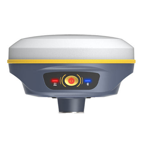
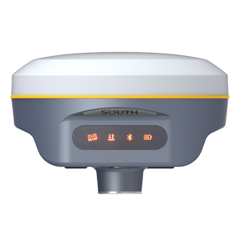
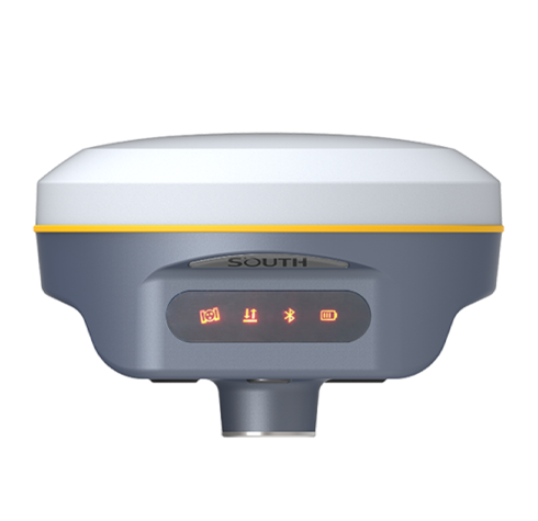
| Buttons | Dual-button | |
| Indicators | 3 LED indicators | |
| Display | 1.3-inch color touch screen | |
| Web interaction | With the access of the internal web interface management via WiFi or USB connection, users are able to monitor the receiver status and change the configurations freely | |
| Voice guidance | It provides status and operation voice guidance, and supports Chinese/English/ Korean/Spanish/Portuguese/Russian/Turkish | |
| Secondary development | Provides secondary development package, and opens the OpenSIC bservation data format and interaction interface definition | |
| Cloud service | The powerful cloud platform provides online services like remote manage, firmware update, online register and etc. |
*The data comes from the SOUTH GNSS Product Laboratory, and the specific situation is subject to local actual usage.


 点击咨询客服
 点击咨询客服