
试验仪器


全站仪
-

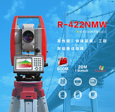
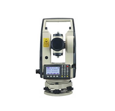
宾得R-422NMW经典防爆全站仪
宾得R-422NMW经典款防爆测量全站仪:高性能、快速简易
-
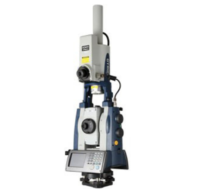
索佳GYRO XII自动全站式陀螺仪全站仪
索佳GYRO XII自动全站式陀螺仪全站仪无需考虑通视条件,无需任何辅助,也不需要已知点,可以在任何时间、任何地点快速精确测定真北方向,给出坐标方位角。
-
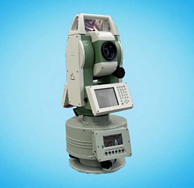
GTA1605自动陀螺全站仪
苏州一光GTA1605自动陀螺全站仪是一种精密定向设备,它由陀螺仪和全站仪组成,可在短时间内自动确定目标相对于北向的精确方位角。
-
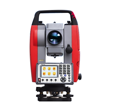
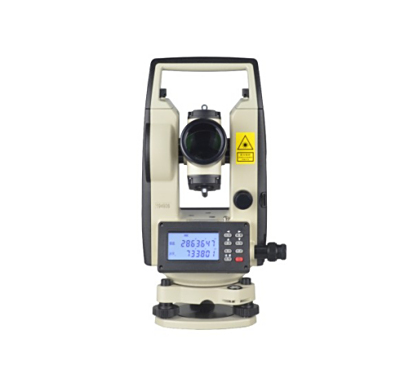
宾得ATX普及型全站仪
宾得ATX普及型全站仪,操作软件人机交互,面谈式面板设省计,作业时效更高,节省工期
RTK
-
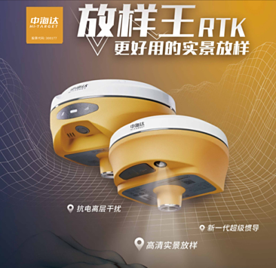
中海达V300 单北斗版
中海达V300 单北斗版
-
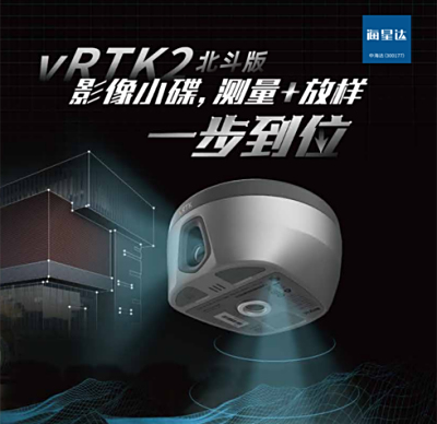
海星达vRTK2 单北斗版
海星达vRTK2 单北斗版
-
天宝RTX差分账号(全球)
天宝RTX差分账号(全球)全球跟踪基站网络在全球部署了120个左右的跟踪基站,对GNSS观测值进行实时跟踪和存贮,将GNSS观测值时发送给分别位于欧洲和美国的控制点
-
天宝RTX差分账号(内陆及近海300海里)
天宝RTX差分账号(内陆及近海300海里)全球跟踪基站网络在全球部署了120个左右的跟踪基站,对GNSS观测值进行实时跟踪和存贮,将GNSS观测值时发送给分别位于欧洲和美国的控制点


三维激光扫描仪
-
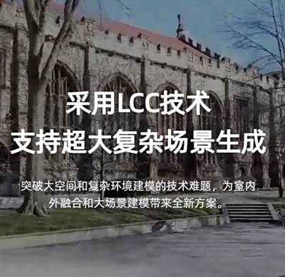
其域创新 Lixel CyberColor
基于Multi-SLAM+3DGS的新一代三维内容生产技术
-
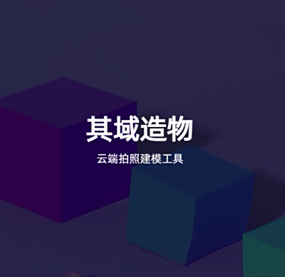
其域创新 其域造物
云端拍照建模工具
-
其域创新 灵光L2 Pro
灵光L2 Pro是其域创新的旗舰级手持扫描建模设备,深度集成了多源感知模块,结合AI智能,带来堪比前代机型后处理质量的点云数据,SLAM设备进入“0处理时代”。
-
其域创新 灵光K1
灵光K1是其域创新推出的小型手持扫描建模设备

无人船
-
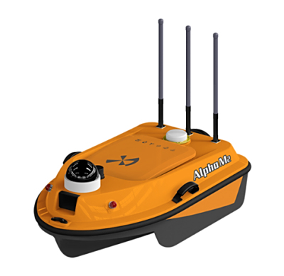
阿尔法M测量无人船
阿尔法M测量无人船产品参数价格购买介
-
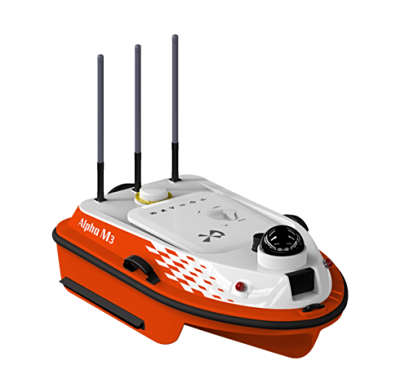
阿尔法M3测量无人船
阿尔法M3测量无人船产品参数价格购买介绍
-
阿尔法M2测量无人船
阿尔法M2测量无人船产品参数价格购买介绍
-
阿尔法H2 全功能水文船
阿尔法H2 全功能水文船产品参数价格购买介绍


管线探测
-
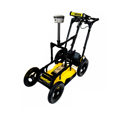
加拿大NOGGIN(诺金)地质雷达NOGGIN1000
加拿大NOGGIN(诺金)地质雷达NOGGIN1000 通过其在极地,沙漠等极端环境下的勘探成果,证明其是先进的地质雷达之一。
-
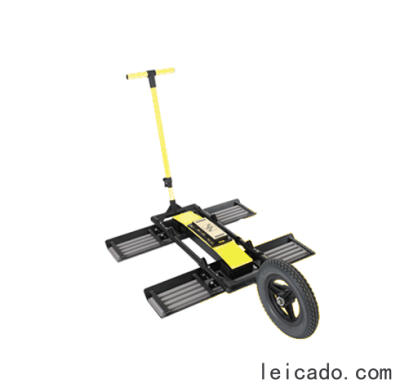
加拿大NOGGIN(诺金)地质雷达 NOGGIN 500
加拿大NOGGIN(诺金)地质雷达NOGGIN500 新一代地质雷达系统,利用高频电磁波成像原理,探测地下物体的形状、大小、埋深及方向。
-
加拿大NOGGIN(诺金)地质雷达NOGGIN 250
加拿大NOGGIN(诺金)地质雷达NOGGIN 250 数字视频记录器,功能强,数据采集简单
-
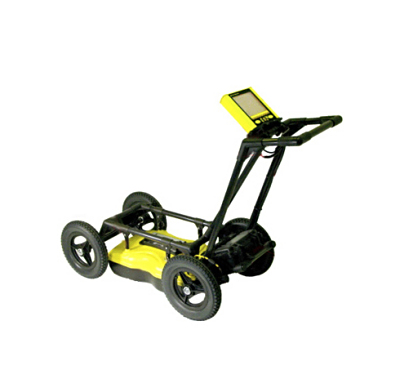
加拿大NOGGIN(诺金)地质雷达NOGGIN100
加拿大NOGGIN(诺金)地质雷达 NOGGIN 100 频带宽,探测范围广、适应能力强、抗干扰能力强
无人机
-
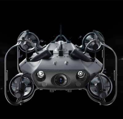
潜鲛 X100水下无人机
潜鲛 X100水下无人机,行业级水下无人机:全向抗流 流畅操控革命性划时代的海洋智能装备
-
系留供电系统
TePo 系留供电系统
-
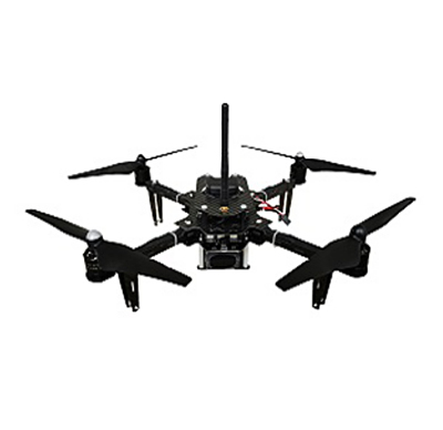
教育科研无人机
教育科研无人机

CORS账号
-
千寻CORS账号 RTK年账号
千寻CORS账号,全国29省市服务覆盖,是高密度、高稳定性、高承载能力的地基增强站,形成一张覆盖全国的地基增强网,千寻CORS账号能够支持全国任意位置上对高精定位的需求。
-
中国移动CORS账号中海达RTK绑定年账号月账号
中国移动CORS账号中海达RTK绑定年账号月账号
-
中国移动CORS账号南方RTK绑定年账号月账号
中国移动CORS账号南方RTK绑定年账号月账号
-
千寻CORS1天账号
千寻CORS账号能够为全国地区(除西部无人区及台湾地区)提供位置数据服务。


经纬仪
-
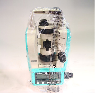
南方NT-023电子经纬仪
南方多功能电子经纬仪NT-023,传承经典,全新设定经纬仪概念。小机身、大性能,配合棱镜可测300米,让距离不再遥远,加上很高的性价比,很多工程用户会用。
-
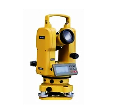
南方NT-02D电子经纬仪
南方NT-02D顶管型激光电子经纬仪,专为顶管施工而生。采用全新高功率激光管,配合全新优化的同轴激光结构,确保光斑可视距离大于1000米,避免传统顶管定向方法搬站的不便与局限,提供稳定可靠的激光指向。
水准仪
-
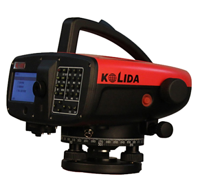
科力达KL-03电子水准仪
科力达KL-03按国标内置一到四等测量程序及限差,同时提升自动化程度,自动观测、自动记录,可现实图形化电子气泡精平,配合双水泡观察口,让架设仪器更轻松,精度更高。
-
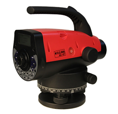
科力达KL-07电子水准仪
科力达KL-07提升自动化程度,自动观测、自动记录;水泡反射镜与上壳一体化,反射镜尺寸更大,可视范围大,稳定性强;提高工作效率和测量精度,避免人为误差,测量精度为0.7mm/km。
-
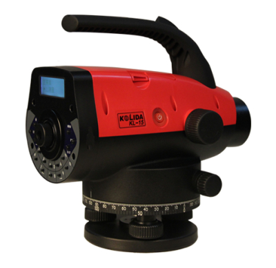
科力达KL-15电子水准仪
科力达KL-15提升自动化程度,自动观测、自动记录;提高工作效率和测量精度,避免人为误差,测量精度为1.5mm/km;水泡反射镜与上壳一体化,反射镜尺寸更大,可视范围大,稳定性强。
-
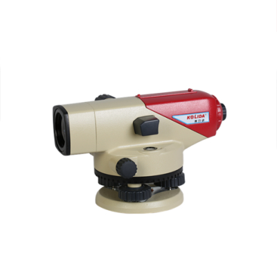
科力达DSZ2自动安平水准仪
科力达DSZ2自动安平水准仪采用新型的自动补偿器,性能稳定,防水、防尘性能优秀。测量精度:1.0mm/km
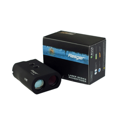
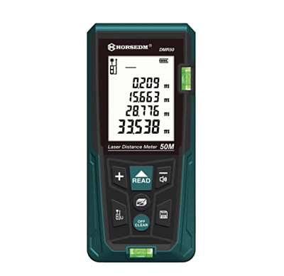
测距仪
-
南方LDMS-60测距仪
南方LDMS-60测距仪-南方高精度激光测距传感器采用工业级设计,高等级防尘防水,支持室外测量,无惧阳光,数据传输快,环境适应性高,是监测的好帮手。
垂准仪


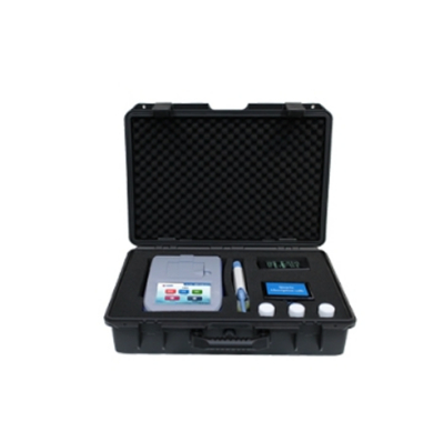
水质检测仪器
-
天尔便携式叶绿素a测定仪
天尔便携式叶绿素a测定仪,海水养殖检测/自来水检测/企业污水检测/养殖渔业检测/科学研究检测/环保机构检测
-
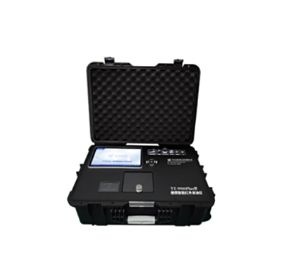
天尔便携式智能红外测油仪
天尔便携式智能红外测油仪适用于各级环保局的环境监测站应急监测、石油石化环境监测、海洋环境监测、水利水文监测和第三方环境检测公司等众多领域
-
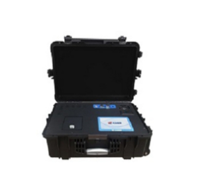
天尔便携式紫外测油仪
天尔便携式紫外测油仪主要应用在地表水、地下水和海水中的石油类的测定.适用于环境监测系统,石油化工、水文水利、自来水公司、污水处理厂、火力发电厂、钢铁企业、高校科研教学
-
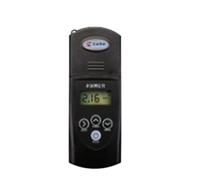
天尔便携式余氯总氯测定仪
天尔便携式余氯总氯测定仪适用于地表水、地下水等多种水体余氯总氯的测定。
测深仪-流速设备
-
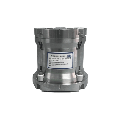
声学多普勒速度仪
其还具有测流功能,能够测量设备所在区域的流场剖面,包括载体航线上的走航式观测和潜标、浮标等载体应用的流场定点观测。
-
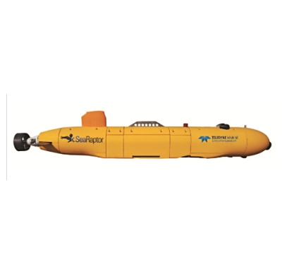
自治水下机器人AUV
Gavia AUV是一款方便运输的自容式、模块化调查平台,通过在临时租用船或岸上操作,可传输高质量的数据。
-
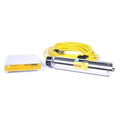
USBL水下定位系统
Easytrak能快速部署,易于操作,确保新手用户可以在数分钟内安装设置后开展追踪任务。其设计融合了大量功能,为水下各种任务提供稳定和准确的追踪。
-
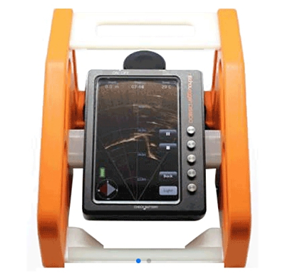
潜水员手持高清监测系统
MRS 900扫描声呐和摄像头、照明灯、温度传感器等选配件组成,应用于搜救和回收、水下观测和检查和军事活动领域。
无损检测仪
-
混凝土气泡间距系数测定仪
硬化混凝土气泡间距系数分析仪,用于测定硬化混凝土中气泡的数量、大小和间距,用来计算混凝土的含气量、气泡比表面积和间距系数等气泡参数,以研究混凝土的抗冻性能和鉴定外加剂的引气性能等。
-
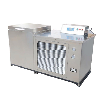
混凝土快速冻融实验机
混凝土快速冻融实验机是我公司自行研发生产的一款混凝土耐久性检测仪器,此款混凝土快速冻融实验机采用智能热存储技术的技术上再做改进,使产品设计更紧凑
-
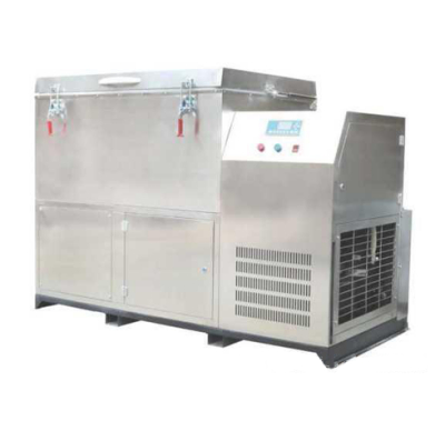
多功能建材冻融试验机(又名混凝土慢速冻融试验机)
全自动建材冻融实验机是我公司自行研发生产的一款混凝土耐久性检测仪器,此款全自动建材冻融实验机具有高自动化、高效率、并可配置上位机软件实现远程监控
-
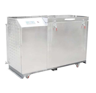
混凝土硫酸盐干湿循环试验箱
全自动混凝土硫酸盐干湿循环试验箱是我公司自行研发生产的一款混凝土耐久性检测仪器,此款混凝土硫酸盐干湿循环试验箱采用专用中文液晶控制器控制,操作简单
监测观测测绘附件
-
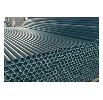
PVC测斜管
PVC测斜管高精度,耐腐蚀,用于位移与沉降
-
木制经纬仪全站仪通用三脚架
木制经纬仪全站仪通用三脚架,抗摔耐用,便携我稳固,适用多种场景
-
优级铝合金塔尺
优级铝合金塔尺用于工程测量,施工方便
-
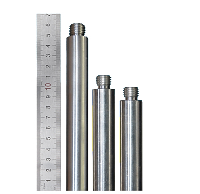
铝合金连接杆
铝合金连接杆经久耐用,可多杆连接在一起使用


 点击咨询客服
 点击咨询客服